Samples and Benchmark requests for multiple industries:
Bone Densitometry:
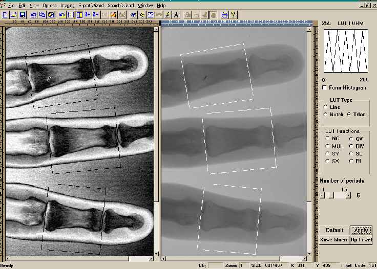
Osteoporosis: Image of suspicious areas enhanced for premium viewing, areas of localization are clearly marked by the practitioner.
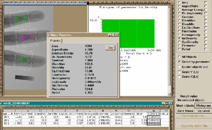
Bone density estimation: Segmented suspicious bone areas are quantified, exported to Microsoft Excel® and real bone density is recalculated by the user (conversion ratio is supplied by the user).
CT Scan
Cytology:
Lab Automation in Microscopy: Blood count and full statistics are performed using automatic image processing in batch using Macro Library previously saved by the user.
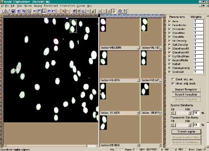
Search within processed file: Previously detected objects are compared with selected by the user template object. All areas of the processed image ranked based on calculated similarity to the template. Numeric results are prepared for exporting, new template is saved for future use.
Cytometry
Dentistry
Dermatology
DNA Sequencing
Mammography
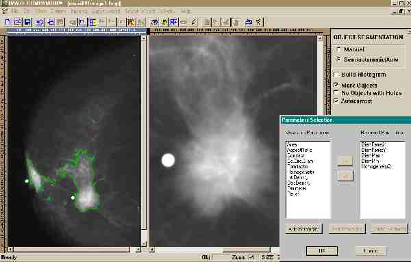
Computer-Aided Detection in Radiology: Mammographic image automatically processed with the user defined objects settings (through multi-thresholding) and suspicious areas are clearly marked and quantified. Such areas can be compared with enhanced view of the tumor area (right part of the display window).
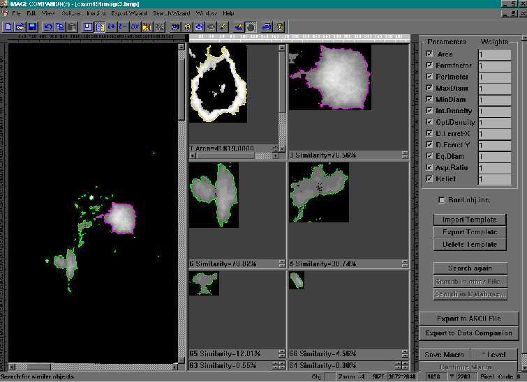
Indexing and retrieval from database: Previously detected suspicious areas are compared with cancer template imported from the other cases. All areas of the processed image ranked based on calculated similarity to the template (selected by the user).
MRI
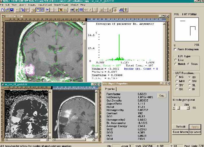
Brain MRI: Tumor detection, quantification and full statistics are performed using automatic image processing in batch using Macro Library previously saved by the user. Steps included image enhancements and then semi-automatic segmentation
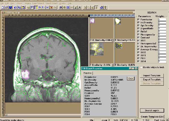
Search with a list of previously created tumor templates: Previously detected and selected by radiologist tumor is compared with a list of previously saved tumor templates from different cases. The detected tumor ranked based on calculated relative similarity to the selected templates. Numeric results are prepared for exporting, new template is added to the database for future use.
Ophthalmology
Ultrasound
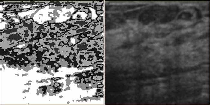
Computer-Aided Detection in Ultrasound: The current method of detection and analysis of suspicious areas is based on manual inspection of the acquired images. It is subjective and error-prone. Our technology not only can view and display comprehensively (enhanced view on the left and traditional view on the right), but can detect, quantify and search images too.
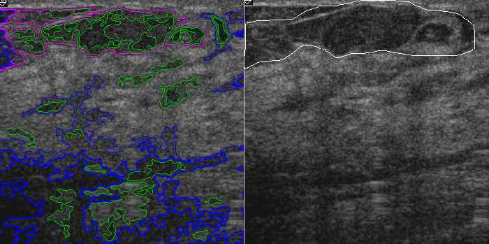
Quantification and Scoring of suspicious area: Previously detected suspicious areas are automatically detected and quantified. They can then be compared to one marked by radiologist (accuracy test) and numerically scored to the level of suspicion.
Virology
X-Ray Data
Mapping Applications
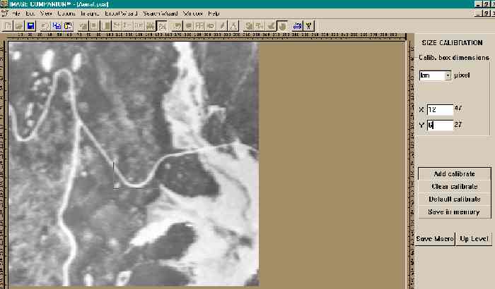
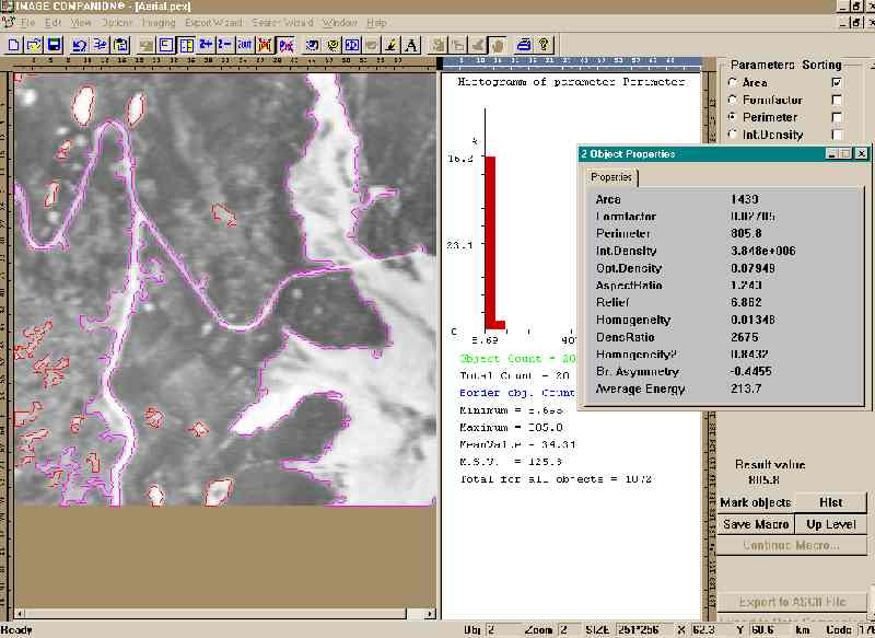
Bird View Image:File is calibrated to metric units (if needed and in this benchmark to hypothetical measurements)

"Flooding areas" are segmented and automatically detected. All numeric statistics and histograms are displayed. Individual measurements displayed for selected objects.
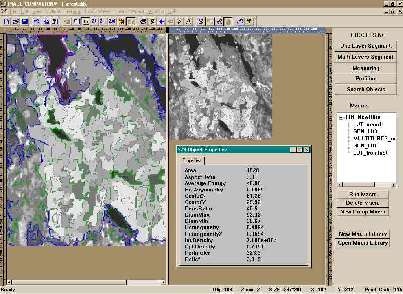
Multi-threshold segmentation is automatically performed. All areas classified into a number (user select) of clusters according to the level of visual damage due to brush fires.
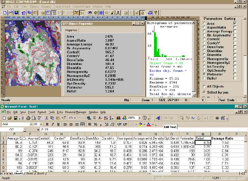
Fire damage evaluation: Numeric and statistical results exported to Excel and numeric evaluation of a fire damage is calculated (the formula the damage ration is supplied by the user)
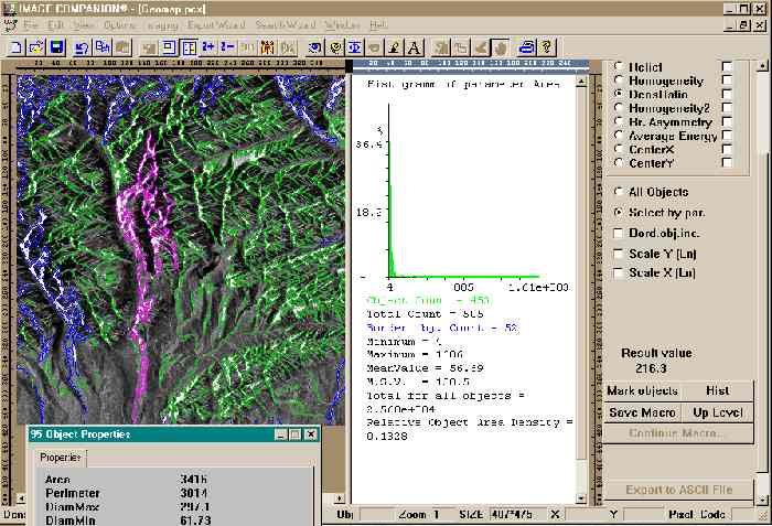
Snow volume evaluation: Image is segmented and snow areas are automatically detected. All numeric statistics and histograms are displayed. Individual measurements displayed for selected objects. Numeric and statistical results exported to Excel and numeric evaluation of a spring water volume is calculated (all formula for volume calculations are supplied by the user)
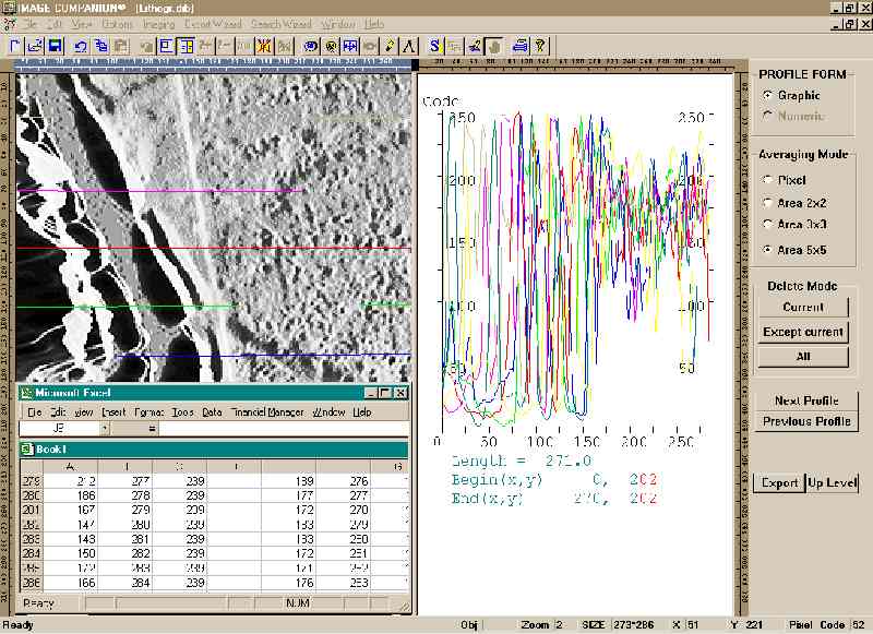
Landscape grid-type profiling results exported to Excel for numeric reconstruction of the map (all formulas for the reconstruction are supplied by the user)
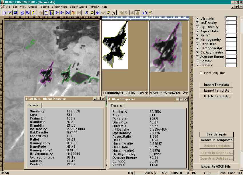
Reconnaissance Photo: Image is automatically segmented and search for imported from database template is performed. Saved template for one of the F16 Jet photos found to have the highest relative similarity.
Meteorology
Reconnaissance

Bird View Image:File is calibrated to metric units (if needed and in this benchmark to hypothetical measurements)

"Flooding areas" are segmented and automatically detected. All numeric statistics and histograms are displayed. Individual measurements displayed for selected objects.

Multi-threshold segmentation is automatically performed. All areas classified into a number (user select) of clusters according to the level of visual damage due to brush fires.

Fire damage evaluation: Numeric and statistical results exported to Excel and numeric evaluation of a fire damage is calculated (the formula the damage ration is supplied by the user)

Snow volume evaluation: Image is segmented and snow areas are automatically detected. All numeric statistics and histograms are displayed. Individual measurements displayed for selected objects. Numeric and statistical results exported to Excel and numeric evaluation of a spring water volume is calculated (all formula for volume calculations are supplied by the user)

Landscape grid-type profiling results exported to Excel for numeric reconstruction of the map (all formulas for the reconstruction are supplied by the user)

Reconnaissance Photo: Image is automatically segmented and search for imported from database template is performed. Saved template for one of the F16 Jet photos found to have the highest relative similarity.
Utility Services

Bird View Image:File is calibrated to metric units (if needed and in this benchmark to hypothetical measurements)

"Flooding areas" are segmented and automatically detected. All numeric statistics and histograms are displayed. Individual measurements displayed for selected objects.

Multi-threshold segmentation is automatically performed. All areas classified into a number (user select) of clusters according to the level of visual damage due to brush fires.

Fire damage evaluation: Numeric and statistical results exported to Excel and numeric evaluation of a fire damage is calculated (the formula the damage ration is supplied by the user)

Snow volume evaluation: Image is segmented and snow areas are automatically detected. All numeric statistics and histograms are displayed. Individual measurements displayed for selected objects. Numeric and statistical results exported to Excel and numeric evaluation of a spring water volume is calculated (all formula for volume calculations are supplied by the user)

Landscape grid-type profiling results exported to Excel for numeric reconstruction of the map (all formulas for the reconstruction are supplied by the user)

Reconnaissance Photo: Image is automatically segmented and search for imported from database template is performed. Saved template for one of the F16 Jet photos found to have the highest relative similarity.

